
At Bryce Point before the sun clears the rim, the temperature is usually somewhere in the twenties, even in a month when the parking lot down at the entrance is warm by nine. Nothing down in the amphitheater is moving. That's the part that's easy to miss: it looks like a finished landscape, thousands of orange spires standing in neat, ancient rows, when what you're actually looking at is a demolition in progress, running so slowly that a single visit can't show you a single frame of it changing.
Almost nothing about this park holds still long enough to be pinned down with one clean fact, starting with its own name. It isn't a canyon. The people who lived alongside it for seven hundred years had a better name for it than the one that stuck. The lodge, the road, even the park's own designation took years to settle into anything permanent. And on the way out, this piece ends on a number Bryce Canyon itself couldn't quite agree on with its own last year's numbers, which turns out to be the most honest place to land, for a park built entirely out of rock that hasn't decided to fall yet.
Not Actually a Canyon
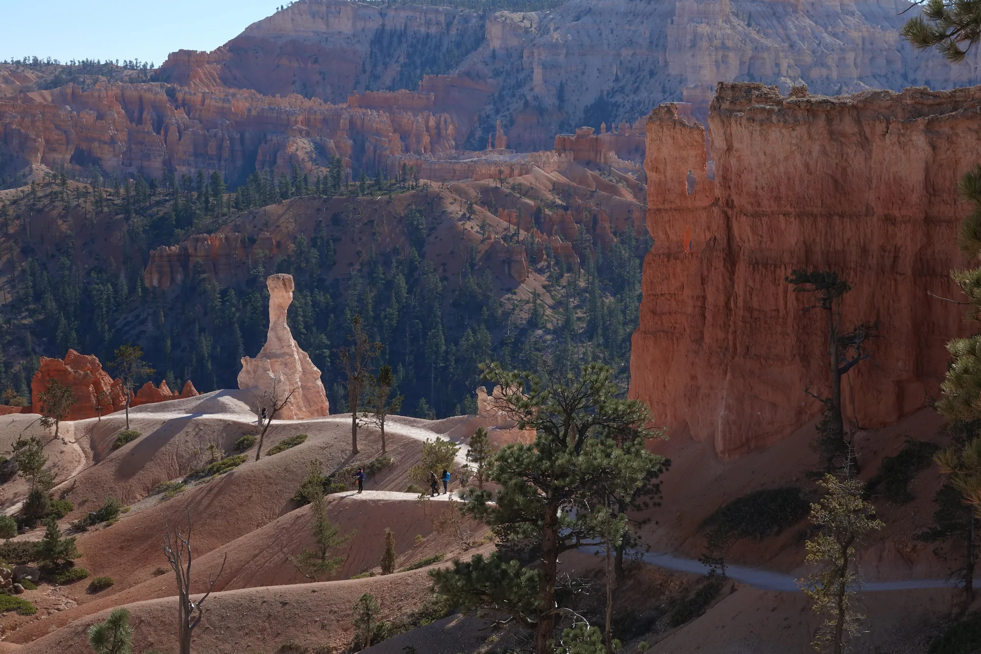
Start with what the name gets wrong. A true canyon is river-cut, and no river runs through Bryce, or ever has. What's actually in front of you is the eastern edge of the Paunsaugunt Plateau, worn back into a row of amphitheaters that only look canyon-shaped from the rim. The rock doing the work is called the Claron Formation: pink and white limestone, sandstone, and shale, laid down around fifty million years ago at the bottom of a shallow lake system, back when this stretch of Utah was low, wet, and nothing like the high desert it is now.
The plateau sits mostly between eight and nine thousand feet, high enough that it swings across freezing on roughly two hundred days a year. Water works into a crack in the limestone, freezes, and expands by about nine percent, which is enough to pry the rock apart one hairline at a time. Rainwater does a second, quieter job alongside it, picking up carbon dioxide from the air and soil and turning just acidic enough to dissolve the softer parts of the limestone unevenly. A flat cliff face doesn't erode back evenly under that combination. It erodes into fins, then windows, then the freestanding spires called hoodoos.
None of them are finished. They're mid-collapse, every one, just slowly enough that a whole human lifetime of visits wouldn't show the shape change.
Red Painted Faces
The Paiute were using this plateau by around 1200 A.D., moving through it seasonally to hunt and gather rather than settling it year-round, and they had their own name for the amphitheater below Sunrise Point: Angka-ku-wass-a-wits, red painted faces. In 1936, a Paiute elder named Indian Dick gave an account of why the rock looked the way it did. Before this place was stone, he said, it was full of the Legend People, To-when-an-ung-wa, beings shaped like animals and birds. They behaved badly, so the trickster Coyote turned every one of them to stone exactly where they stood. Look closely, he said, and you can still see their faces, painted, standing in rows, some of them leaning on each other the way they must have stood the moment they were caught.
There's no evidence of a permanent Paiute village on this exact plateau, which is easy to misread as the place not mattering much to them. It reads differently once you know why. The plateau's game and plant cycles moved with the seasons, elk and deer working downslope in winter and back up as the snow cleared, and the people who depended on them moved with them. A place can sit at the center of how people lived without a single foundation ever having been poured into it.
Turn This Route Into a Real Plan
Pick your dates and your crew: the AI trip planner builds the day-by-day for Bryce Canyon, walking order between stops included.
Open the Trip PlannerFour Names in Thirteen Years
In July 1915, a U.S. Forest Service supervisor named J. W. Humphrey rode out here from nearby Panguitch, not expecting much. "You can perhaps imagine my surprise at the indescribable beauty that greeted us," he wrote afterward, and he spent the rest of his posting pushing for the roads and publicity the rim had never had before. A husband and wife, Ruby and Minnie Syrett, opened simple lodging nearby in 1920, called, about as plainly as tourism ever names anything, Tourist's Rest.
The Union Pacific Railroad bought the Syretts' property in 1923, the same year the canyon was proclaimed a national monument, and hired architect Gilbert Stanley Underwood to design a proper lodge, finished in May 1925. It's still standing, now a National Historic Landmark. And the name kept moving under all of it. President Warren G. Harding proclaimed it Bryce Canyon National Monument on June 8, 1923. Congress relabeled it Utah National Park less than a year later, June 7, 1924. It didn't become Bryce Canyon National Park, the name that finally stuck, until February 25, 1928, and even then the boundaries weren't final; the park reached its current 35,835 acres in 1931.
If a company renaming itself twice in one year sounds like corporate chaos, this plateau changed its legal name three times in under thirteen. In 1930, a tunnel opened connecting Zion to the highway east of it, and for the first time a single road trip could string together Zion, Bryce, Cedar Breaks, and the Grand Canyon's North Rim as one circuit, which is roughly the trip a lot of visitors are still making, whether or not they know Underwood's name.
What Keeps Surviving Here
If you take only one trail below the rim, this is the one locals point people to: Queen's Garden combined with the Navajo Loop, 2.9 miles round trip with about 625 feet of elevation change, rated moderate, and the only maintained trail in the park that actually drops you down among the hoodoos instead of just looking at them from above. Budget two to three hours. It also happens to be Utah prairie dog habitat, and that's a real recovery story with nothing to do with rock: the species, found only in this corner of Utah and nowhere else on earth, collapsed from around 95,000 animals in the 1920s to about 3,000 by the 1970s before federal protection intervened. Bryce now has its own reintroduced population, over 600 animals across ten separate colonies, and as a keystone species their burrowing aerates soil for plants and feeds the hawks, badgers, and rattlesnakes that hunt them.
Higher up, near Yovimpa Point, a different kind of survivor grows at the edge of what should be able to live here at all. The Great Basin bristlecone pine handles thin, cold, nine-thousand-foot air by essentially refusing to keep time the normal way. In a year the ground never fully thaws, the tree simply doesn't grow a ring. It holds its needles for more than forty years at a stretch instead of shedding them annually like most conifers. The oldest bristlecone near Yovimpa is estimated at over 1,600 years old, and a tree with only 900 visible rings can be far older than 900, because some years, by design, never got a ring at all.
Counting in the Dark
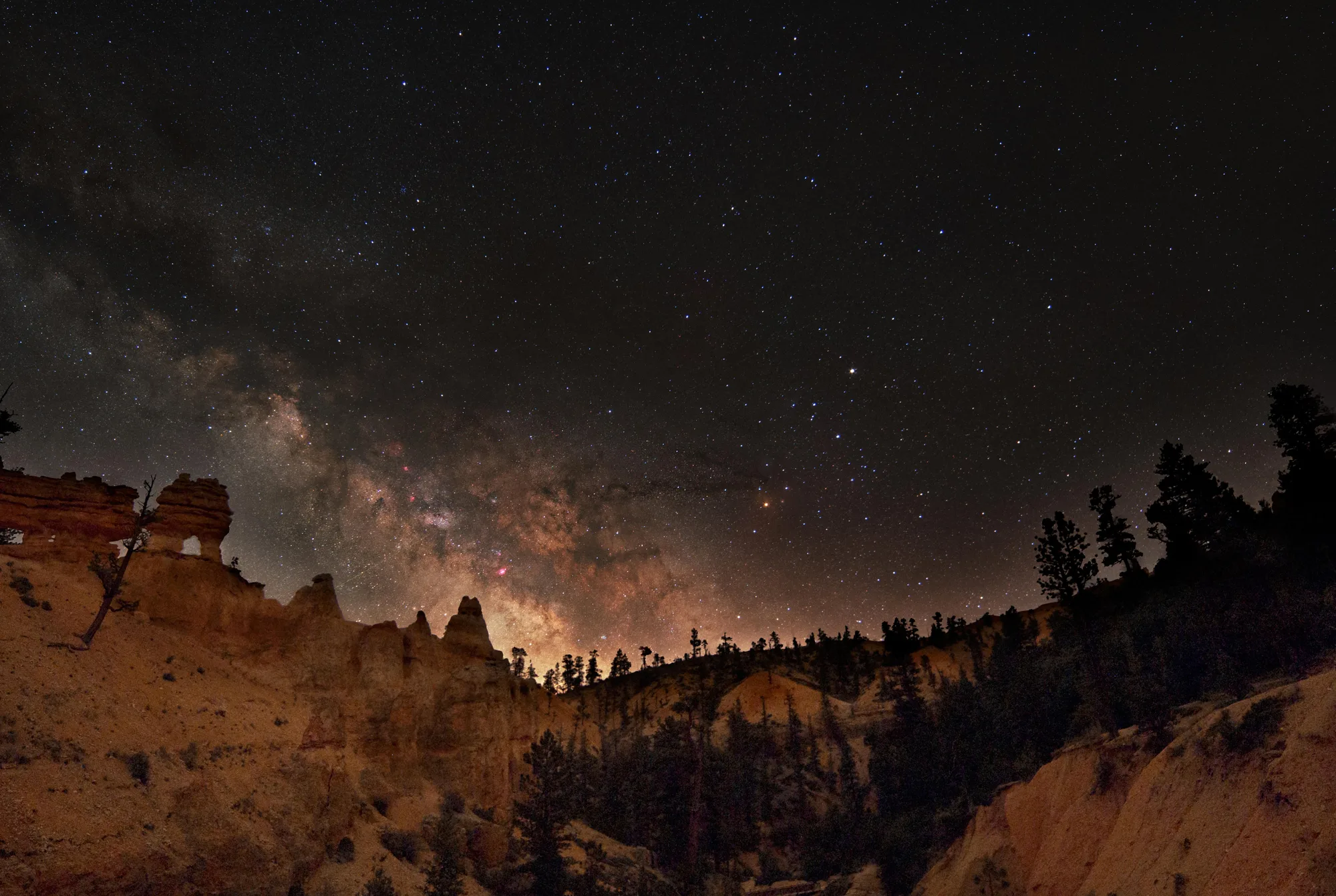
Rainbow Point is the highest stop on the drive, around 9,100 feet, and once the sun goes down it's part of the reason Bryce Canyon was certified an International Dark Sky Park on August 13, 2019, recognition the park had worked toward for more than a decade, built on an astronomy program that was already fifty years old at the time. The certification mostly confirmed what rangers here had been telling visitors for half a century already: this is one of the least light-polluted skies left in the country, and the same thin, dry air that stunts a bristlecone's growth ring is what keeps the sky this clear.
Here's the honest number on the way out. Bryce Canyon reported 1,967,367 recreation visits in 2025, a real-looking drop from 2024's 2,498,075. Except the park also changed how it counts that year, switching from total shuttle-bus boardings, which counted the same rider every time they reboarded, to unique passengers only. Run 2025's actual numbers through the old counting method and you get roughly 2,437,461, a real but much smaller 2.4 percent dip, not the half-million-visitor cliff the headline comparison suggests. Both numbers are true. They're just not measuring the same thing.
Which is, in the end, the whole park in one fact. The hoodoos below this rim aren't standing still either, they're just losing material slowly enough that no single visit can catch the difference, the same way no single year's visitor count can tell you what's actually happening without asking how it was taken. Stand here after dark, under a sky this clear, and the rock in front of you looks exactly as permanent as it did to J. W. Humphrey in 1915. It isn't. It's just patient, and so, it turns out, is the math.
The Claron Formation's age and depositional setting, and the freeze-thaw and carbonic-acid dissolution mechanics behind hoodoo formation (roughly 200 freeze-thaw days a year), checked against USGS's own geology-of-Bryce-Canyon page. The Paiute name Angka-ku-wass-a-wits and Indian Dick's 1936 Legend People account checked against NPS.gov/brca's American Indian History page, quoted close to the source rather than paraphrased flatter. J. W. Humphrey's 1915 visit and his own quoted line, Ruby and Minnie Syrett's 1920 Tourist's Rest, Union Pacific's 1923 purchase, Gilbert Stanley Underwood's lodge (finished May 1925), the 1930 Zion–Mt. Carmel tunnel, and the three-name designation history (national monument June 8 1923, Utah National Park June 7 1924, Bryce Canyon National Park Feb 25 1928, 35,835 acres by 1931) checked against NPS.gov/brca's own Park History page. The Queen's Garden/Navajo Loop trail stats checked against NPS.gov's own trail page. The Utah prairie dog collapse and recovery numbers (95,000 to 3,000 rangewide, 600+ reintroduced at Bryce across 10 towns) checked against NPS.gov/brca's Utah Prairie Dog page. The bristlecone pine's estimated 1,600+ year age at Yovimpa Point and its missing-ring growth pattern checked against NPS.gov/brca's bristlecone pine page. The August 13, 2019 Dark Sky certification and the 50-year astronomy-program figure checked against NPS.gov/brca's own 2019 press release. The 2025 visitation figures and the shuttle-boardings-to-unique-riders methodology change, including the old-method-equivalent estimate of roughly 2,437,461, checked against Bryce Canyon's own March 2026 visitation news release; both numbers are reported here exactly as the park itself reported them, deliberately not resolved down to one figure. One widely repeated line, Ebenezer Bryce's supposed remark about the canyon being a hard place to lose a cow, is not used anywhere in this piece: it has no citable source on NPS.gov or in Bryce's own biography, however often it gets quoted elsewhere.