
In 1999, an anthropologist named Douglas Deur sat down with Klamath elders and started asking what they knew about the mountain that used to stand where the lake is now. Over three years he interviewed roughly a hundred and five tribal members, and when he laid their accounts side by side, in order, he found something that reads like a geologist could have written it: small eruptions first, then explosions, then fire pouring down every side of the mountain, then the top of it falling in. The elders were not paraphrasing a textbook. Their people never left.
Mount Mazama's collapse, about 7,700 years ago, ranks among the largest volcanic eruptions anywhere on Earth in the last ten thousand years, big enough that its ash is still findable across seven states and into Canada. What's stranger than the eruption itself is that a story describing it, in something close to the right order, has been told by the people who watched it happen for roughly two hundred generations, outlasting the mountain it describes.
Before the Fall
Before it collapsed, Mount Mazama stood roughly twelve thousand feet, a stratovolcano built up over hundreds of thousands of years the same slow way its living neighbors in the Cascades were, layer by layer, eruption by eruption. In scale it would have looked something like Mount Hood or Mount Shasta look today, a single peak visible for a hundred miles on a clear day, with glaciers on its upper flanks and forest running most of the way up its sides. Nothing about it looked temporary.
It was. The magma chamber beneath it had been filling for centuries, and when it finally let go, it emptied fast enough that the mountain above it had nothing left to stand on.
It Didn't Happen All at Once
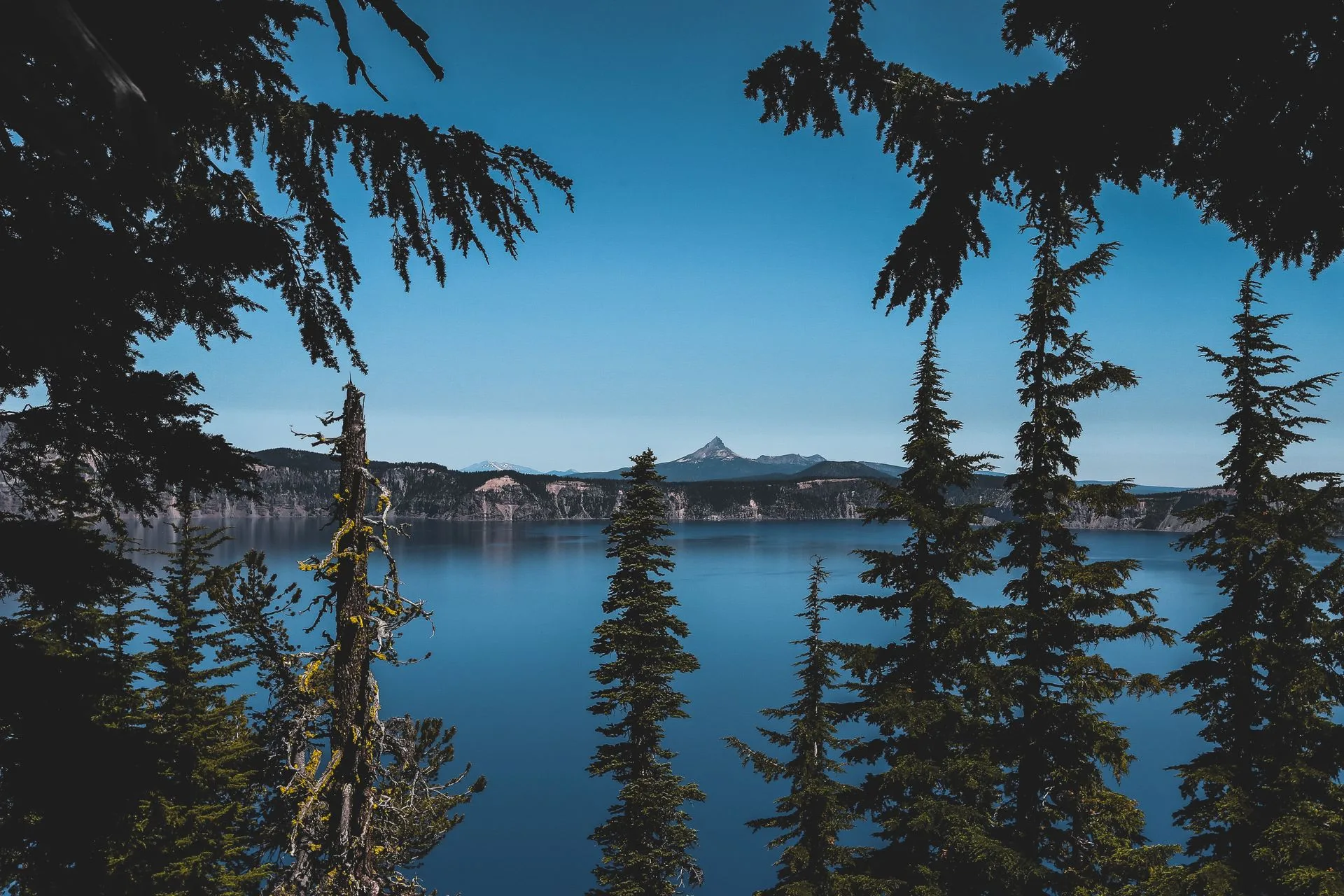
The first sign came from what's now called Llao Rock, a lava dome on the caldera's north wall that erupted roughly 7,900 years ago. The Cleetwood eruptions followed within about two hundred years, meaning Mazama was actively venting, in fits and starts, for nearly the length of time this country has existed, before the mountain itself gave way. The climactic eruption is dated by the U.S. Geological Survey at roughly 7,700 years ago, a figure worth treating as a rounded consensus rather than an exact date. A 2022 peer-reviewed study using high-resolution tephra analysis calculated a more precise calibrated age of 7,633 years before present, give or take about fifty years, close to the popular number but not identical to it.
When the climactic phase came, it came at a scale that's hard to picture. The eruption ejected an estimated 176 cubic kilometers of tephra, one of the largest eruptions of the last ten thousand years anywhere on the planet, and pyroclastic flows, hot avalanches of ash and rock, raced down every valley draining the mountain for distances up to seventy kilometers, more than forty miles. Ash fell across the Pacific Northwest and settled as far away as southern Canada. Some secondary sources describe the eruption as a VEI 7, the same magnitude class used for history's largest blasts, a figure consistent with the tephra volume the USGS itself has published, even where the agency's own pages stop short of using that exact label.
Plan Your Crater Lake Visit
The Rim Drive traces the outline of what used to be the side of a mountain. The trip planner can help you time a loop around it against the season and the crowds.
Open the Trip PlannerGiiwas, and the War Beneath It
The core version of the story involves two spirits: Llao, of the world beneath the mountain, and Skell, of the sky above. Llao climbs to the peak and is rejected by Loha, a chief's daughter, and in his fury rains fire down on the Klamath below. Skell descends from Mount Shasta to fight him, and two medicine men sacrifice themselves in the underworld to help him win. Skell then collapses the mountain's top over the pit where Llao is trapped and covers it with water, and that water is the lake. A second, older telling ends differently, with Llao defeated and torn apart, his body becoming what's now Wizard Island. Oral literature carries more than one version the way any story told for two hundred generations will, and that isn't a discrepancy to resolve so much as a feature of how the story has survived.
Deur's own account of his fieldwork is careful about what a story like this can and can't prove. "Reported ethnographic facts may be based on empirically verifiable events, mythic events, and, quite commonly, a combination of the two," he wrote, grounding his conclusion not in any single telling but in how consistently the sequence, minor eruptions, then massive explosions, then pyroclastic flows, then collapse, recurs across tellers who never compared notes with each other. One elder he recorded described it this way: "When the Chief of the Below World came up from his lodge below the mountain, his tall form towered above the snow-capped peaks." Earlier documentation of the tradition goes back further still, to ethnographers Leslie Spier in 1930 and Robert Spencer in 1952, long before Deur's own fieldwork began.
A New Cone, and an Old Boundary
Wizard Island, the cinder cone visible from most points on the rim today, formed roughly 7,200 years ago, built by renewed eruptions inside the caldera the collapse had just carved out. Crater Lake became the United States' fifth national park on May 22, 1902, protecting the lake but not, in practice, the Klamath people's claim to it. An 1864 treaty had ceded more than twenty-two million acres of Klamath, Modoc, and Yahooskin Paiute land, describing a peak-to-peak boundary that by its own wording should have included giiwas. That boundary was never honored, and according to reporting by Klamath Tribes News in May 2026, a later court-ordered redress of tribal lands excluded giiwas from what was ultimately returned, an active grievance rather than a settled piece of history, worth attributing directly to that reporting rather than smoothing into neutral summary.
- Pre-collapse height ~12,000 FT
- Climactic eruption ~7,700 YEARS AGO
- Tephra ejected ~176 CUBIC KM
- Pyroclastic flow reach UP TO 70 KM (43 MI)
- Wizard Island formed ~7,200 YEARS AGO
Facts and figures checked against the U.S. Geological Survey's geologic history summaries for Mount Mazama, the National Park Service's introduction to Crater Lake, a 2022 peer-reviewed tephra dating study published in Frontiers in Earth Science, and Douglas Deur's ethnographic research on Klamath oral tradition, published through PDXScholar. Contemporary reporting on the giiwas land dispute is drawn from Klamath Tribes News. Where the popular "7,700 years ago" eruption date differs from the more precise calibrated radiocarbon range in the peer-reviewed literature, both are given rather than one silently preferred.
Deur's interviews are now part of how the park itself explains the caldera to visitors who stand on the rim without knowing any of this. It is one of a small number of places on Earth where a laboratory's timeline and a story passed down for two hundred generations describe the same sequence of events, in the same order, neither one needing the other to be believed.