
The walk from the ghost town of Kennecott onto Root Glacier takes about ninety minutes, crampons recommended, and ends on ice that's easy to reach and, in a few places along its eastern edge, easy to walk straight into.
A Walk Onto the Ice, and Sometimes Into It
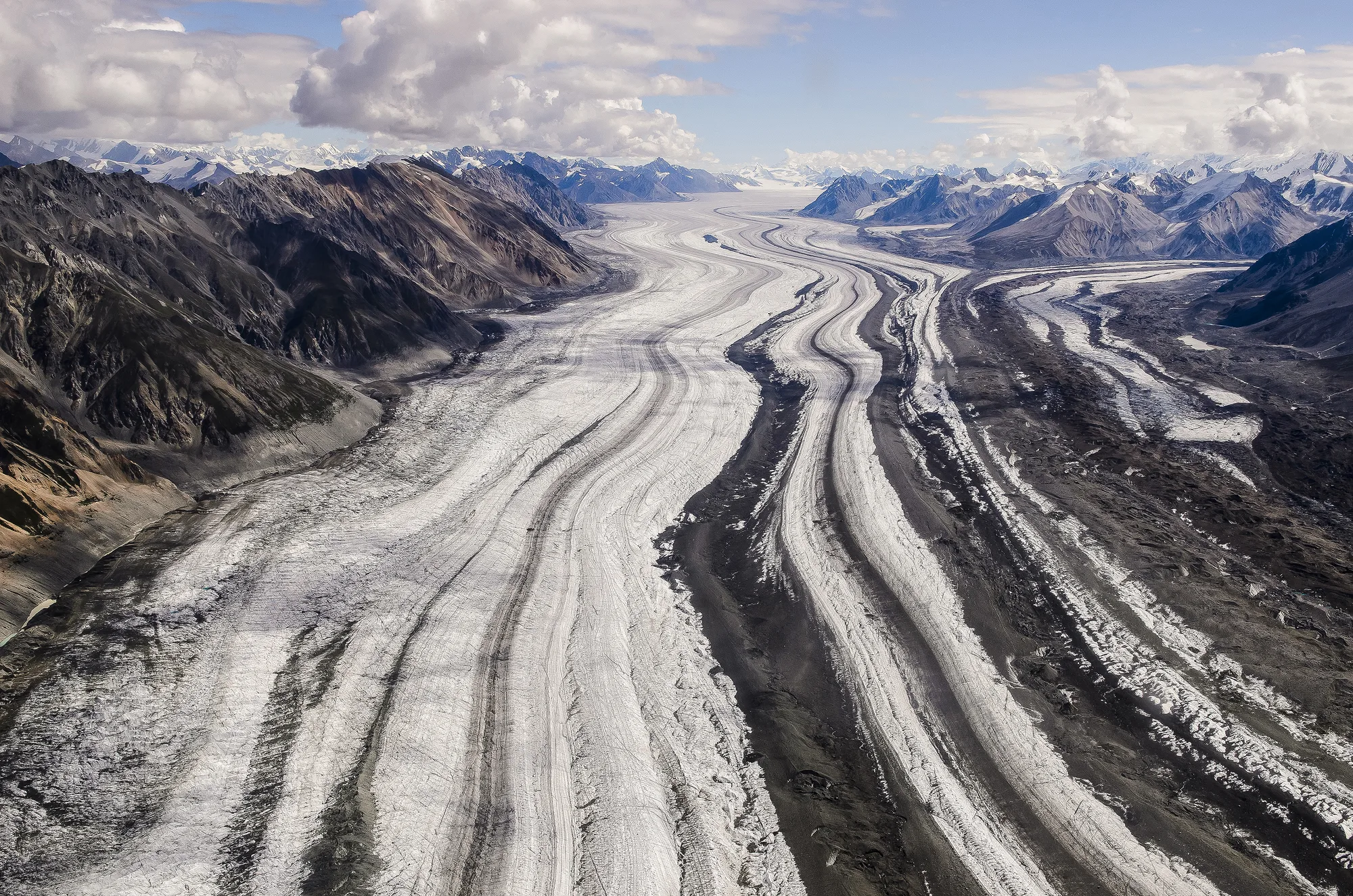
Root Glacier starts with a moderate mile-and-a-half walk from the historic mining town of Kennecott, then another few miles across the ice itself for hikers headed toward the old Erie Mine tram cables, a two-to-six-hour outing over easy to moderate terrain, past views of Mount Blackburn, Regal Mountain, and Donoho Peak. The National Park Service calls it the most accessible glacier in a park that holds roughly 5,000 square miles of glacial ice, and it recommends crampons or ice spikes and an experienced guide for anyone planning to get onto the ice itself, since the surface hides crevasses and patches of rotting ice.
Along the glacier's eastern edge, near Kennecott, meltwater has carved something more dramatic than a simple walk across ice: lateral caves, formed where creeks run in along the moraine and warm water hollows out cavities with a roof of glacier ice over a floor of sediment or bare rock. They're a genuinely different way to experience a glacier, walking under ice instead of just across it, but the Park Service is direct about the risk: falling ice and rock, sudden collapse, and flooding are all real hazards, and these caves aren't a place to improvise without the right gear and guidance.
A moulin, the other kind of ice cave that forms here, is a vertical shaft where surface water drops straight down into the glacier, and it isn't something you walk into at all without serious climbing equipment.
- Access ~1.5 MI WALK FROM KENNECOTT
- Round trip 2-6 HRS · EASY TO MODERATE
- Gear CRAMPONS/ICE SPIKES & GUIDE RECOMMENDED
- Park's glacial ice ~5,000 SQ MI TOTAL
Plan a Guided Ice Walk
Licensed guide services run daily trips onto Root Glacier from Kennecott and McCarthy in summer.
Open the Trip PlannerA Park Where the Numbers Stop Making Sense
Wrangell-St. Elias is the largest national park in the United States, an area equal to about six Yellowstones, and it's also the largest wilderness area anywhere in the National Wilderness Preservation System. Four major mountain ranges, the Wrangell, St. Elias, Chugach, and the eastern Alaska Range, physically converge inside its boundaries, which is part of why the park holds nine of the sixteen highest peaks in the entire country. Mount St. Elias alone reaches 18,008 feet, the second-highest point in the United States after Denali.
The glaciers scale the same way. Nabesna Glacier runs roughly 53 miles, the longest valley glacier in North America. Malaspina Glacier, out along the coast, is larger than the entire state of Rhode Island, the largest glacier of its kind, a piedmont glacier, on the continent. Hubbard Glacier, nearby, ranks among the largest and most active tidewater glaciers anywhere in North America. Root Glacier, the one most visitors actually walk on, barely registers next to any of them.
Standing inside a lateral ice cave on Root Glacier, ducking under a ceiling of blue-tinted ice with a creek running past your boots, it's easy to forget that the same slow mechanics, meltwater working its way through ice year after year, are also what carved out a 53-mile valley glacier and a piedmont of ice bigger than a small state, just a few hundred miles away, at a scale that stopped being humanly graspable a long time ago. The park was designated a World Heritage Site alongside its neighboring Canadian parks, forming the largest international protected wilderness on Earth. One short walk from an old mining town is as close as most people will ever get to feeling the size of it.
- Size LARGEST U.S. NATIONAL PARK · ~6X YELLOWSTONE
- Mountain ranges converging WRANGELL, ST. ELIAS, CHUGACH, E. ALASKA RANGE
- Mount St. Elias 18,008 FT · 2ND HIGHEST IN THE U.S.
- Nabesna / Malaspina Glaciers ~53 MI LONG / LARGER THAN RHODE ISLAND
Root Glacier trail distance, terrain, and safety guidance checked against the National Park Service's official Root Glacier page. Ice cave formation and hazards checked against NPS's official article on glacier ice caves on the Root and Kennicott glaciers. Park size, mountain range convergence, peak elevations, and glacier superlatives checked against NPS's official "What's So Special About Wrangell-St. Elias" page.
Most visitors never see more than a sliver of Wrangell-St. Elias. There's no road that crosses it, no single overlook that takes in more than a fraction of what's actually inside the boundary. Root Glacier, reached on foot from a hundred-year-old mining town, is one of the only places where the park lets you touch its scale directly instead of just reading it off a sign. It's a small piece of a very large answer to a question most people don't think to ask until they're standing on the ice: how big is too big to see?