
Lower a foot-wide white disk into most lakes and you will lose sight of it within twenty or thirty feet, however clean the water looks from shore. Lower one into Crater Lake and it can still be visible more than a hundred feet down, a depth first measured in 1896 and checked, on and off, ever since.
The reason traces back to what the lake doesn't have. No river feeds it and none drains it, which means almost nothing enters the water except rain and snow, and almost nothing clouds it. That absence, more than anything else, is why Crater Lake reads as one of the clearest and bluest bodies of water on the planet, and why the National Park Service has spent more than a century measuring exactly how clear.
A Closed Basin
Crater Lake sits inside the caldera left by Mount Mazama's collapse, a closed basin with no inlet stream and no outlet stream. It fills entirely from precipitation, more than five hundred inches of snow a year at the rim on average, along with whatever rain falls directly on the water. There is no river carrying sediment in, no runoff dragging in organic matter from a surrounding watershed the way there would be at a typical mountain lake. The water's surface elevation sits at roughly 6,173 feet, and it fluctuates by only a few feet year to year since evaporation and seepage are its only way out.
The Color Is the Water Itself
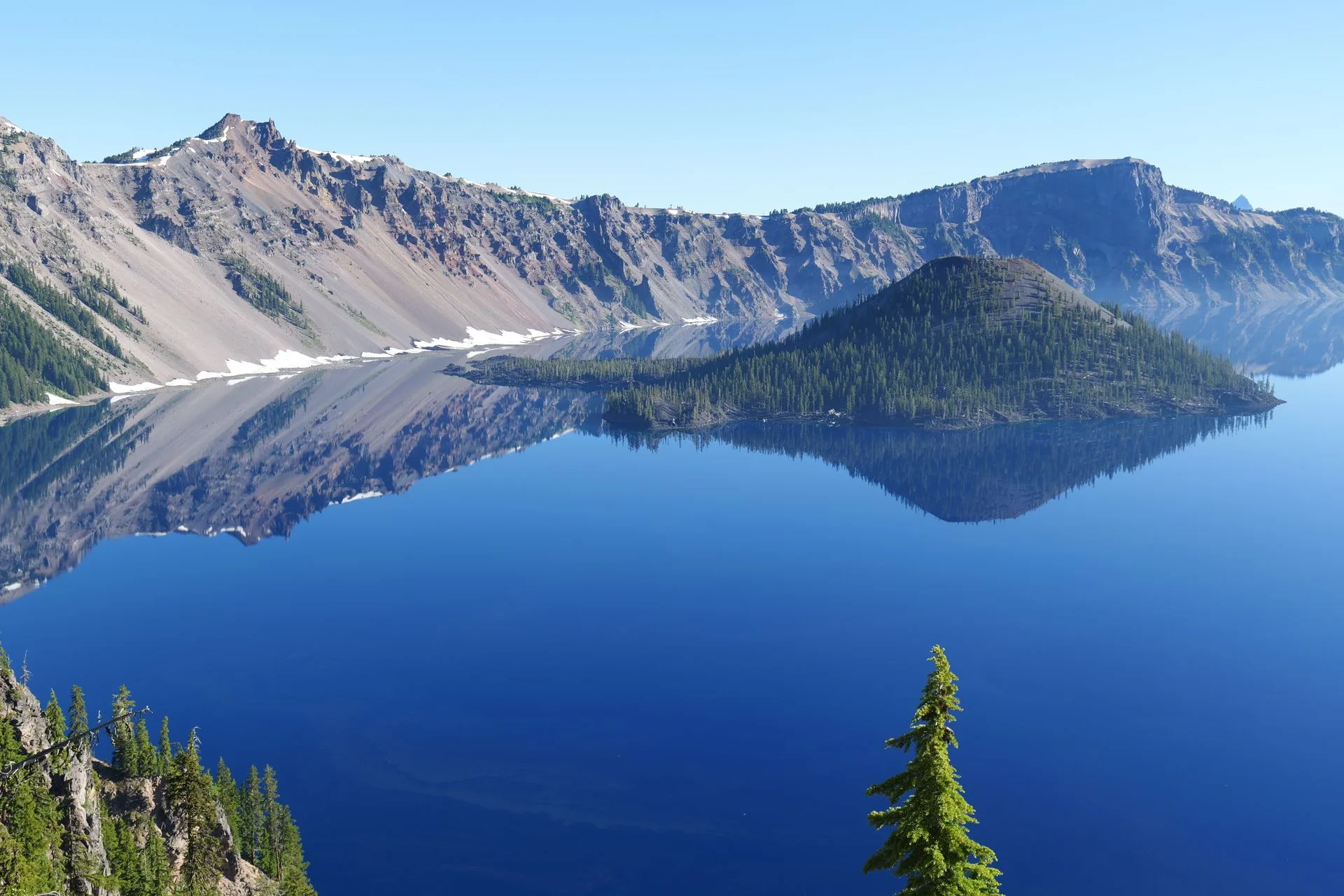
With almost no particles to scatter light on their way down, sunlight in Crater Lake travels far deeper before it bounces back toward the surface, and it's the water molecules themselves, not algae or sediment, doing the scattering, the same molecular process that turns the sky blue. Shorter blue wavelengths scatter more readily than red or green ones, and research on the lake has found blue light penetrating to depths greater than three hundred feet, far past where the other colors have already been absorbed. Researchers with the Crater Lake Institute have also reported that the lake's surface waters have greater ultraviolet transparency than any other known lake or ocean on Earth, with a research lake in Antarctica the closest rival.
Plan Your Crater Lake Visit
The clearest water is usually the calmest water. The trip planner can help you time a rim drive or a boat tour around the conditions that show the lake at its bluest.
Open the Trip PlannerThe Same Disk, on a Rope, for 130 Years
The first Secchi disk reading at Crater Lake was taken in 1896, reaching thirty meters, about ninety-eight feet, before it disappeared from view. Readings continued sporadically over the following decades, in 1913, 1937 through 1939, 1954, 1960, and 1968 through 1969, before annual monitoring finally began in 1978 and has continued every year since. A widely repeated figure puts the single deepest reading on record at a hundred and thirty-nine feet, taken in June 1997, though that specific number traces to the Crater Lake Institute rather than a National Park Service page directly, worth treating as widely reported rather than officially confirmed.
Depth itself has its own measurement history. An 1886 survey team led by geologist Clarence Dutton sounded the lake from a rowboat at a hundred and sixty-eight locations using piano wire, and came up with a maximum depth of 1,996 feet, remarkably close to today's figure using nothing more sophisticated than wire and patience. A 1959 survey took more than four thousand echo soundings, and John Byrne published the first full bathymetric map in 1965. The number in use today, 1,943 feet, making Crater Lake the deepest lake in the United States, comes from a 2000 multibeam sonar survey, the most precise measurement yet taken.
Getting Clearer, Not Murkier
The National Park Service's Long-Term Limnological Monitoring Program has tracked the lake continuously since 1983, building on that earlier, sporadic record. Its own conclusion, stated plainly in the agency's monitoring materials, is that both Secchi disk depth and the depth of light penetration show a slight increase in clarity over the last forty-plus years. That's the opposite of what tends to happen to a body of water this exposed to a warming climate and a changing watershed.
Not everything the program has found is reassuring. Signal crayfish, a species not native to the lake, expanded from covering about half the shoreline in 2008 to nearly ninety-five percent of it by 2020. A dinoflagellate algal bloom was first observed near Cleetwood Cove in the fall of 2016. Snowpack, the lake's only real source of water, has been declining by roughly 1.6 inches of water-equivalent per decade.
- Maximum depth 1,943 FT (2000 SONAR SURVEY)
- First Secchi reading 1896, ~98 FT
- Annual monitoring since 1978
- Blue light penetration 300+ FT
Facts and figures checked against the National Park Service's Secchi disk monitoring page, its Long-Term Limnological Monitoring Program materials, and its introduction to Crater Lake's depth and elevation figures, supplemented by the Crater Lake Institute for the ultraviolet-transparency comparison and the widely cited 1997 clarity record, both flagged in the text as secondary-sourced rather than confirmed directly on an NPS or USGS page.
The same white disk on a rope that went into the water in 1896 is still, in principle, how park staff check the lake today, an old, unglamorous piece of equipment that nobody has needed to improve on. A hundred and thirty years of readings say the water is doing the same thing it was doing before anyone thought to measure it, only slightly clearer.