
The road into Cedar Grove drops nearly five thousand feet from Grant Grove, switchbacking down into a canyon the Sierra Club once compared to Yosemite Valley for scale. For most of the twentieth century, whether that canyon floor would stay open to the sky was a genuinely open question. Los Angeles wanted to dam it for power. It took over sixty years, a self-published photography book, and an act of Congress to settle the matter for good.
The park most visitors drive through today isn't the park Congress first created here, and the ground under Cedar Grove itself wasn't even part of Kings Canyon National Park until 1965, a quarter century after the park's name first appeared on a map.
General Grant National Park Came First, and It Was Tiny
On October 1, 1890, Congress created General Grant National Park, the fourth national park in the country's history, following Yellowstone and trailing Sequoia National Park by exactly one week. It protected only about four square miles, roughly twelve hundred acres, centered on the General Grant Tree, the sequoia now nicknamed the Nation's Christmas Tree. Nearly all of what people today call Kings Canyon, the deep granite gorge along the South Fork of the Kings River, sat entirely outside any park boundary, unprotected national forest land, for the next fifty years.
The Kings River Drops Eleven Thousand Feet
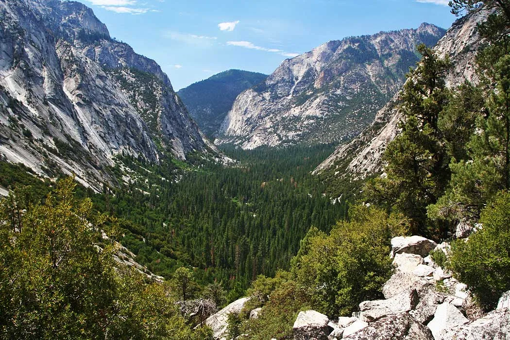
The Kings River falls roughly eleven thousand feet over about eighty miles, the kind of grade that makes hydroelectric engineers take notice, and Los Angeles did, proposing dams at Cedar Grove, at Tehipite Valley further upstream, and at Simpson Meadow. John Muir had pushed for protecting this ground as far back as 1875, and an early preservation bill failed in Congress in 1881. The dam proposals were the more serious threat: they had real political backing, a real city behind them, and the kind of engineering logic that had already justified damming Yosemite's own Hetch Hetchy Valley a generation earlier, a precedent conservationists were determined not to let repeat here.
Plan Your Kings Canyon Visit
Cedar Grove, the canyon floor this fight was actually about, is open seasonally and reached by the same road the dams would have flooded.
Open the Trip PlannerAnsel Adams Self-Published His Way Into the White House
The Sierra Club put Ansel Adams in charge of the congressional push starting in 1936. He met with more than forty members of Congress and presented his photographs directly to lawmakers in January 1937, and a bill still failed that session and the next. So Adams self-published Sierra Nevada: The John Muir Trail in 1938, a large-format book, roughly seventeen by thirteen inches, with photographs hand-glued onto each page as individual plates. A copy reached Interior Secretary Harold Ickes, who was won over enough to carry it personally to a meeting with President Franklin Roosevelt at the White House. Roosevelt liked the book enough to keep Ickes's own copy, which meant Ickes had to ask Adams for a second one. Ickes then championed a new kind of bill, one built around a "wilderness park" model that deliberately limited hotels and roads inside the new park, a framing that finally broke the political stalemate. Representative Bertrand Wesley Gearhart introduced the successful version in 1939; it passed the Senate in February 1940, and Roosevelt signed the Kings Canyon National Park Act on March 4, 1940.
The 1940 Law Didn't Actually End the Dam Fight
The 1940 act abolished General Grant National Park and folded its acreage in as General Grant Grove, inside a new park covering roughly four hundred sixty thousand acres of High Sierra backcountry, later expanded further by a supplementary proclamation that June. But Cedar Grove and Tehipite Valley, the actual canyon floor, were deliberately left out of the new park to appease irrigation and hydropower interests, even as the mountains surrounding them were protected. Los Angeles kept reapplying for dam permits through the 1940s, '50s, and into the early 1960s, finally denied by both state and federal authorities in 1963. The question wasn't formally closed until August 6, 1965, when Congress passed Public Law 89-111, transferring the Tehipite Valley and Cedar Grove canyon floor, about fifty five hundred acres combined, from the surrounding national forests into Kings Canyon National Park itself, ending what the law's own history describes as a debate that had run more than sixty years.
- General Grant Nat'l Park OCT 1, 1890 · ~1,200 ACRES
- Kings Canyon Nat'l Park Act MAR 4, 1940 · ~460,000 ACRES
- Cedar Grove/Tehipite added AUG 6, 1965, P.L. 89-111
- Kings River elevation drop ~11,000 FT OVER ~80 MI
Dates, acreages, and statutory citations checked against the National Park Service's own administrative history of Kings Canyon National Park and the enabling legislation itself, including the 1890 General Grant National Park act, the 1940 Kings Canyon National Park Act, and Public Law 89-111 of 1965. The 1939 sponsorship detail for the successful bill traces to a single secondary source and is presented with that in mind rather than as independently cross-verified.
Drive the switchbacks down into Cedar Grove today and the canyon floor Los Angeles wanted to flood is a campground, a ranger station, and a slow stretch of the South Fork Kings River running exactly where the engineers once penciled in a reservoir. The Kings River, undammed along this stretch, is often described as having the longest uninterrupted drop of any river in the country between its headwaters and the nearest reservoir downstream. Ansel Adams's book is the part of this story people remember. The twenty five years between 1940 and 1965, when half the canyon this park is named for technically wasn't inside it yet, is the part that explains why the fight took as long as it did.